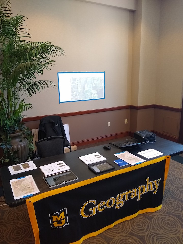
Grad student James Kaemmerer led an interactive remote-sensing activity for the Columbia Young Scientists Expo in Memorial Union Saturday, Feb. 8, using publicly available imagery from the Missouri Spatial Data Information Service (MSDIS). This was the second annual expo, and was well attended by both young and old.
The event, which took place in Stotlar Lounge, was organized by the Connector, a Mizzou organization dedicated to “connecting the people, resources, tools and ideas of UM System research and creative activities for the purpose of research development, communication, engagement and professional development to benefit the people of Missouri, the nation, and the world.”
Designed for children of any age, they learned about geography, physics, meteorology and more through interactive demonstrations. Kaemmerer explains more in this brief Q&A:
Department of Geography: What type of presenters were there, and why did geography participate?
Kaemmerer: Let's see. The geology department brought rocks. The atmospheric science folks had a tornado machine. The Mizzou integrative anatomy group had skulls — lots of skulls. The computer engineering group next to me had an Oculus Rift set up. It was all commendably hands-on. The expo had invited Arts and Science to participate, and we took them up on it.
Department of Geography: How many people did you estimate to be in attendance?
Kaemmerer: Last year they said they had about 300 people. I haven't heard how many attended this year, but the crowd was sustained from about 1:30 to 4:30.
Department of Geography: What kinds of comments did you hear from students and parents about geography opportunities?
Kaemmerer: People responded well to the flood imagery. We tried to choose a few locations that were easily recognizable, such as Jefferson City or the Arch in St. Louis. Yet most found just exploring the imagery in general to be the most compelling. One of the kids spent a couple of minutes just following the Mississippi River northward on the iPad. Others showed remarkable spatial awareness: these two young sisters were easily able to find their former house in Alabama just using the satellite imagery.
Department of Geography: What did you learn in the process of staffing the booth?
Kaemmerer: Promoting geography in the community is very important. Also, there's a lot of opportunity for more student involvement. Other booths had whole groups of graduate students giving demonstrations, likely from their own research projects. I think we could easily expand our presence next year.
Department of Geography: What type of interactive demonstration did you present?
Kaemmerer: We adapted one of Dr. Blodgett's activities from a College of Arts and Science event from last year. We looked at flood imagery from the Missouri and Mississippi Rivers: the before and after shots. I brought two iPads for people to navigate the imagery, and I also projected a larger map on the wall behind me.
Department of Geography: How was it received?
Kaemmerer: I think it was a success. But it's hard to compete with the Herpetology Society who brought live snakes and lizards!
Department of Geography: Overall, how successful was geography’s presence in this program?
Kaemmerer: We held our own, but there is always room for improvement.
Department of Geography: Is this our first or second year participating?
Kaemmerer: First year, I think.
Department of Geography: Should we do it again?
Kaemmerer: Absolutely. The geography department has been doing really well recently in distinguishing ourselves in the university community. We gotta keep up the good work.
Department of Geography: Anything else?
Kaemmerer: Yes. Just thinking out loud here, but if anyone out there wants to help write a grant for us to get one of those cool interactive topographical sandboxes, we'd be much obliged. Or if you happen to have one lying around and want to give it a good home, give us a call. Hint, hint ...